Regions
Aral Sea: things to do and how to visit
Muynak’s stranded ships, the cliffs of the Ustyurt plateau and a night in a yurt on the shore of a vanishing sea.
The Aral Sea was once the fourth-largest lake in the world, an inland sea of more than 66,000 square kilometres fed by the Amu Darya and the Syr Darya. From the 1960s the two rivers were turned almost entirely to the cotton fields, and the sea began to shrink. Within a generation it had split in two, its southern half retreating far into the desert, and a new desert — the Aralkum — appeared on the old seabed. It is one of the great environmental disasters of the last century. The journey here is not a comfortable one, and it stays with people longer than almost anything else in the country.
History
For centuries the Aral was the heart of a fishing economy. Karakalpak and Kazakh communities lived along its shores, and in the twentieth century Muynak became a port with a cannery that supplied fish across the Soviet Union. When the water left, it took the fish, the work and much of the population with it. The salt and dust blown from the dry seabed changed the climate of the whole region, making summers hotter and winters harsher.
Today the northern part of the sea, in Kazakhstan, is slowly recovering behind a dam built in 2005. The southern part, on the Uzbek side, survives as a shallow western basin under the Ustyurt cliffs. Across the dried seabed, saxaul and other desert plants are being planted to hold the sand.
What to see
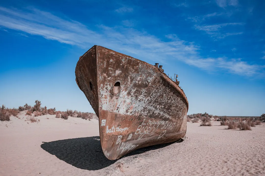
Muynak is where most people first understand the scale of what happened. The town stands on what was the shore; the water is now well over a hundred kilometres away. Below the old lighthouse, a line of rusting fishing boats rests on the sand where it was left. The small local museum keeps photographs and paintings of the port as it was, and they are worth more than any explanation.
Beyond Muynak the track crosses the former seabed and climbs onto the Ustyurt plateau, a vast tableland whose white cliffs once dropped straight into the sea. Along the way, Lake Sudochie and its wetlands gather flamingos, pelicans and migrating birds in spring and autumn. The plateau keeps traces of the old caravan routes between Khorezm and the lower Volga: ruined caravanserais, burial grounds and wells.
The night is spent in a yurt camp near the present shoreline. The silence, the stars and the sunrise over the water are the reason people make the journey.
People and the table
The Karakalpaks, whose republic covers this corner of the country, are known for their felt yurts, heavy silver jewellery and the epic songs of their bakhshi, sung to the dombra. On the road, meals are simple and generous: bread baked in a tandyr, plov, tea and whatever the camp kitchen has brought from Nukus.
Practical notes
The journey takes two days by four-wheel drive from Nukus, with a night in a yurt camp; the drive to Muynak alone is about three hours. Conditions are simple, and the days are long on rough desert tracks. It suits travellers who are comfortable with that, and we plan it with an experienced local driver and full supplies. Nukus is reached by a short flight from Tashkent or by road from Khiva.
Best timeMay–June, September–early October
Weather in Aral Sea
The Aral shore is open desert: hot days, cold nights and a wind that rarely drops. May, June and September are the months for the journey; in July and August the heat is hard, and from November to March the tracks can be impassable.
Right now8°Overcast
Readings for 22:00, Tashkent time · Weather data from MET Norway